文章目录
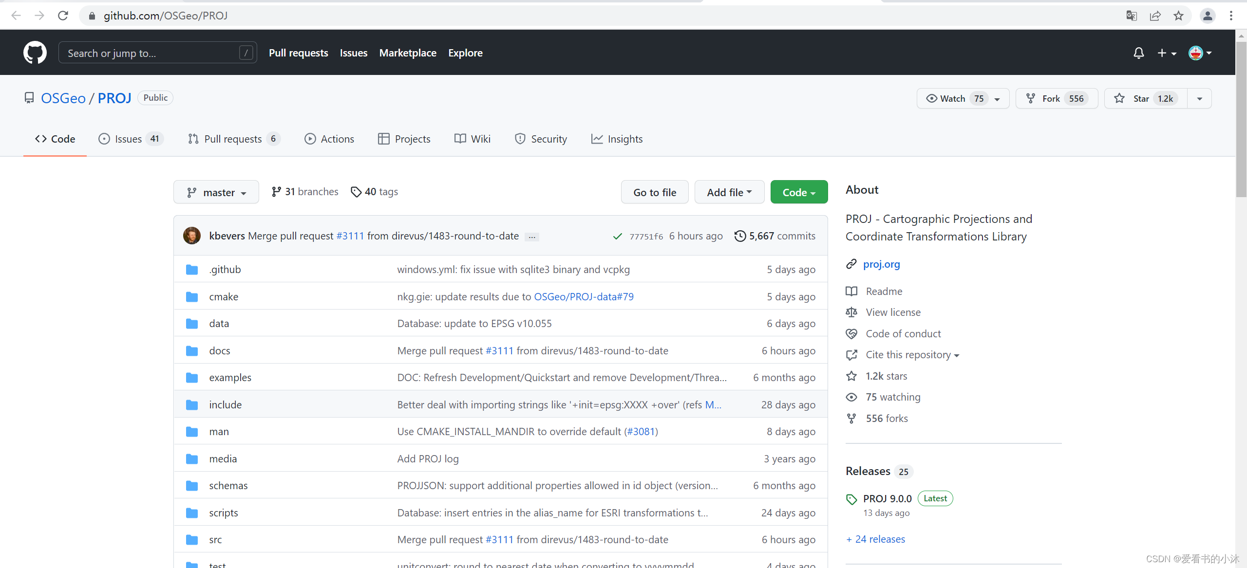
1、OSGeo/PROJ(C++)
https://proj.org/
https://github.com/OSGeo/PROJ
https://download.osgeo.org/proj
PROJ - Cartographic Projections and Coordinate Transformations Library
PROJ 是一款通用坐标转换软件,可将地理空间坐标从一个坐标参考系 (CRS) 转换为另一个坐标参考系 (CRS)。这包括制图投影和大地测量变换。PROJ 在X/MIT 开源许可下发布
PROJ 包括命令行应用程序,用于轻松转换来自文本文件或直接来自用户输入的坐标。除了命令行实用程序之外,PROJ 还公开了一个 应用程序编程接口,简称 API。API 允许开发人员在他们自己的软件中使用 PROJ 的功能,而无需自己实现类似的功能。
PROJ 最初只是作为一个制图应用程序,让用户可以使用许多不同的制图投影将大地坐标转换为投影坐标。多年来,随着需求变得明显,对基准转换的支持也慢慢进入 PROJ。今天,PROJ 支持一百多种不同的地图投影,并且可以使用除了最晦涩的大地测量技术之外的所有方法来转换基准面之间的坐标。

PROJ库的编译依赖库需求如下:
- C99 compiler
- C++11 compiler
- CMake >= 3.9
- SQLite3 >= 3.11: headers and library for target architecture, and sqlite3 executable for build architecture.
- libtiff >= 4.0 (optional but recommended)
- curl >= 7.29.0 (optional but recommended)
1.1 编译sqlite3
https://sqlite.org/download.html
这里静态编译SQLite库的64位版本。

将下载好的两个文件sqlite-amalgamation-3380100.zip、和sqlite-dll-win64-x64-3380100.zip解压到SQLite文件夹内,如下所示:
sqlite-amalgamation-3380100: shell.c 、sqlite3.c、sqlite3.h、sqlite3ext.h
sqlite-dll-win64-x64-3380100.zip:sqlite3.def、sqlite3.dll


打开VS2017,新建一个静态库工程,如下:

将下载的sqlite3的相关,添加到工程里,然后设置“不使用预编译头”,编译工程如下:

1.2 编译libtiff
http://download.osgeo.org/libtiff/


1.3 编译PROJ9

2、pyproj(python库)

2.1 概述
Python interface to PROJ (cartographic projections and coordinate transformations library).

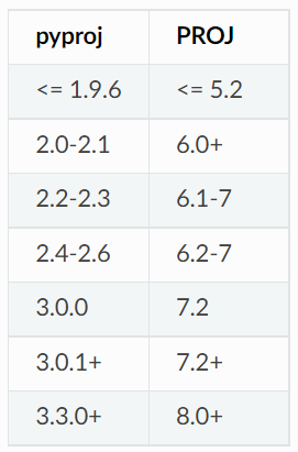
- Minimum supported PROJ version is 8.0
- Minimum supported Python version is 3.8
2.2 安装
https://github.com/pyproj4/pyproj

pip install pyproj

有时候通过pip官方直接安装第三方库会失败,使用国内镜像相对稳定些。
pipy国内镜像目前有:
http://pypi.douban.com/  豆瓣
http://pypi.hustunique.com/  华中理工大学
http://pypi.sdutlinux.org/  山东理工大学
http://pypi.mirrors.ustc.edu.cn/  中国科学技术大学
阿里云:
pip install robotframework -i http://mirrors.aliyun.com/pypi/simple --trusted-host mirrors.aliyun.com 阿里云
豆瓣:
pip install pyproj -i http://pypi.douban.com/simple/ --trusted-host pypi.douban.com

pip list

2.3 代码测试
- Initializing CRS
from pyproj import CRS
crs = CRS.from_epsg(4326)
crs = CRS.from_string("epsg:4326")
crs = CRS.from_proj4("+proj=latlon")
crs = CRS.from_user_input(4326)

- Transformations from CRS to CRS
from pyproj import CRS
crs_4326 = CRS.from_epsg(4326)
crs_26917 = CRS.from_epsg(26917)
print(crs_26917)

from pyproj import Transformer
transformer = Transformer.from_crs(crs_4326, crs_26917)
transformer = Transformer.from_crs(4326, 26917)
transformer = Transformer.from_crs("EPSG:4326", "EPSG:26917")
print(transformer)

- Geodesic line length
from pyproj import Geod
lats = [-72.9, -71.9, -74.9, -74.3, -77.5, -77.4, -71.7, -65.9, -65.7,
        -66.6, -66.9, -69.8, -70.0, -71.0, -77.3, -77.9, -74.7]
lons = [-74, -102, -102, -131, -163, 163, 172, 140, 113,
        88, 59, 25, -4, -14, -33, -46, -61]
geod = Geod(ellps="WGS84")
total_length = geod.line_length(lons, lats)
print(f"{total_length:.3f}")

- Geodesic area
from pyproj import Geod
geod = Geod('+a=6378137 +f=0.0033528106647475126')
lats = [-72.9, -71.9, -74.9, -74.3, -77.5, -77.4, -71.7, -65.9, -65.7,
        -66.6, -66.9, -69.8, -70.0, -71.0, -77.3, -77.9, -74.7]
lons = [-74, -102, -102, -131, -163, 163, 172, 140, 113,
        88, 59, 25, -4, -14, -33, -46, -61]
poly_area, poly_perimeter = geod.polygon_area_perimeter(lons, lats)
print(f"{poly_area:.3f} {poly_perimeter:.3f}")

- WGS84坐标系下,计算该经纬度对应的(x,y)
https://pyproj4.github.io/pyproj/stable/api/proj.html
from pyproj import Proj
p = Proj(proj='utm',zone=10,ellps='WGS84', preserve_units=False)
x,y = p(-120.108, 34.36116666)
# lonlat to xy
print('x=%9.3f y=%11.3f' % (x,y))
# xy to lonlat
print('lon=%8.3f lat=%5.3f' % p(x,y,inverse=True))

lons = (-119.72,-118.40,-122.38)
lats = (36.77, 33.93, 37.62 )
x,y = p(lons, lats)
print('x: %9.3f %9.3f %9.3f' % x)
print('y: %9.3f %9.3f %9.3f' % y)

lons, lats = p(x, y, inverse=True) # inverse transform
print('lons: %8.3f %8.3f %8.3f' % lons)
print('lats: %8.3f %8.3f %8.3f' % lats)

p2 = Proj('+proj=utm +zone=10 +ellps=WGS84', preserve_units=False)
x,y = p2(-120.108, 34.36116666)
print('x=%9.3f y=%11.3f' % (x,y))

p = Proj("epsg:32667", preserve_units=False)
print('x=%12.3f y=%12.3f (meters)' % p(-114.057222, 51.045))

后记
如果你觉得该方法或代码有一点点用处,可以给作者点个赞、赏杯咖啡;╮( ̄▽ ̄)╭
如果你感觉方法或代码不咋地//(ㄒoㄒ)//,就在评论处留言,作者继续改进。o_O???
谢谢各位童鞋们啦( ′ ▽′ )ノ ( ′ ▽′)っ!!!