QGIS插件开发
目标:开发一个使用工具箱工具的插件
环境准备
软件环境
- windows10
- QGIS:3.4.15-1 (包含PyQGIS模块)
- qt-creator-opensource:5.0.3 (来进行过界面修改)
- pycharm
配置系统环境
安装QGIS插件
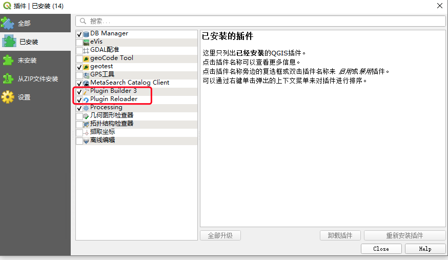
打开QGIS,工具栏,插件——管理并安装插件。
搜索并安装
Plugin Builder:快速创建一个插件项目
和Plugin Reloader:修改插件代码后,在QGIS中不用重启就能刷新插件
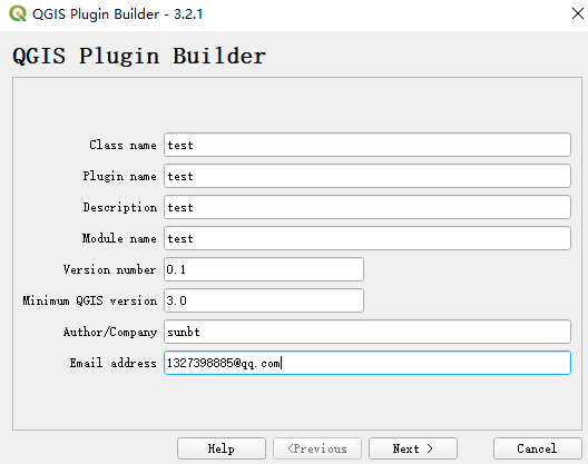
创建项目
这里的Class name是插件的类名,Plugin name是你的插件名,Moule
name是python模块的名称。

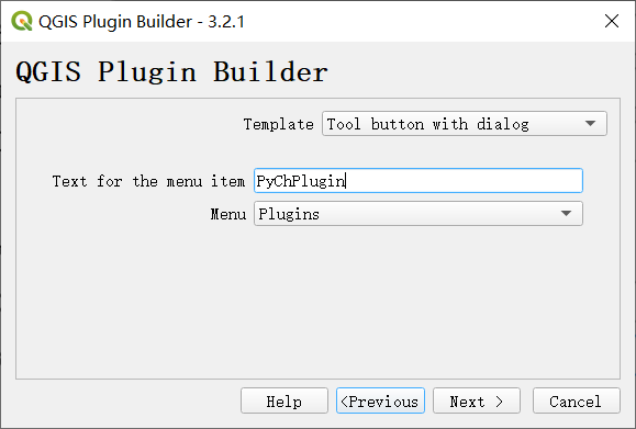
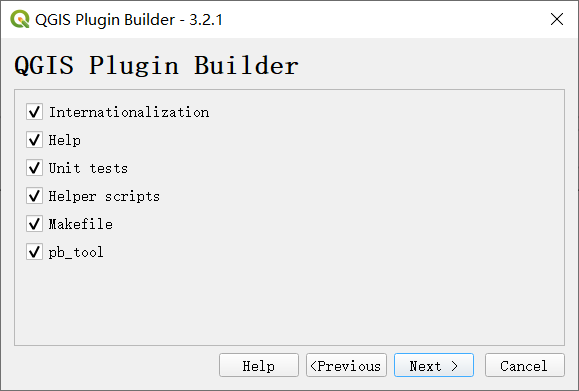
如果不想发布插件,只做练习使用,这里建议大家勾选Flag the plugin as
experimental选项
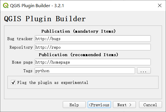
这里选择之前设置的插件工作区的路径,自动生成的插件模板就会放置于该目录下。
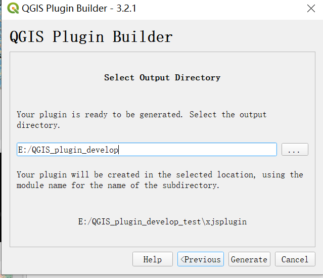
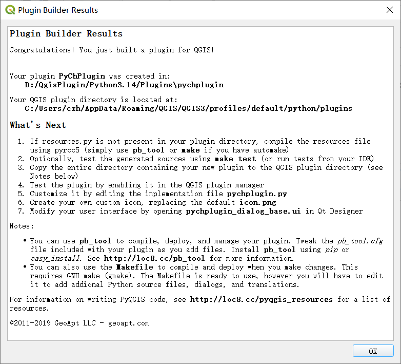
打开到文件夹位置使用cmd运行命令
pyrcc5 -o resources.py resources.qrc
生成如下文件
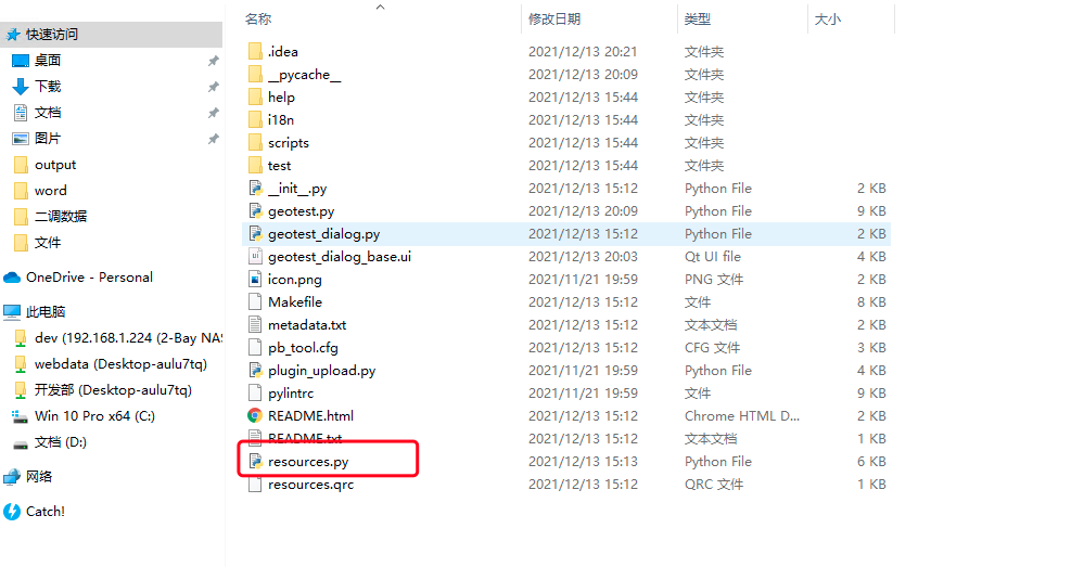
将项目放到插件目录下
打开QGIS,工具栏——设置——用户配置——打开活动配置目录。
在这个/profiles/default文件夹下,打开python/plugins文件夹,QGIS的插件都在这里,把工程放到这个文件夹下。
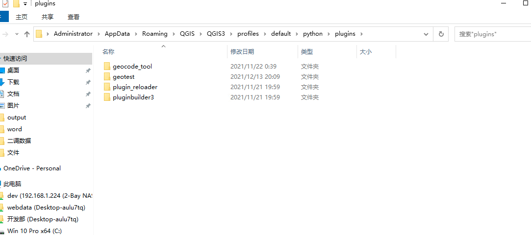
查看效果
关闭QGIS,重启QGIS。
工具栏,插件——管理并安装插件,已安装中,插件赫然在列,勾选上。
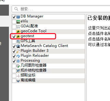
工具图标也在界面上,点击图标,插件如下。
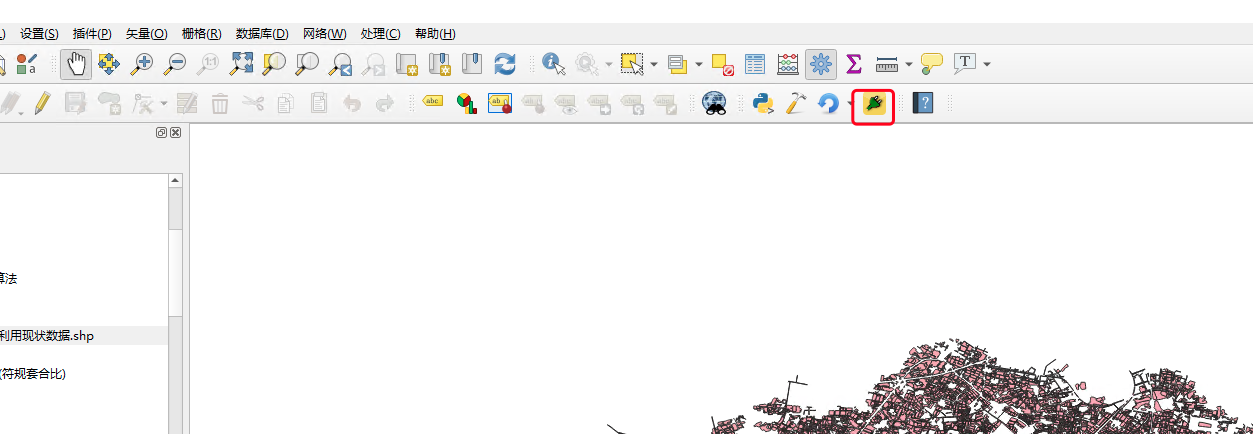
使用QT Creator设置插件页面
使用QC打开项目中的.ui文件
设计界面入下
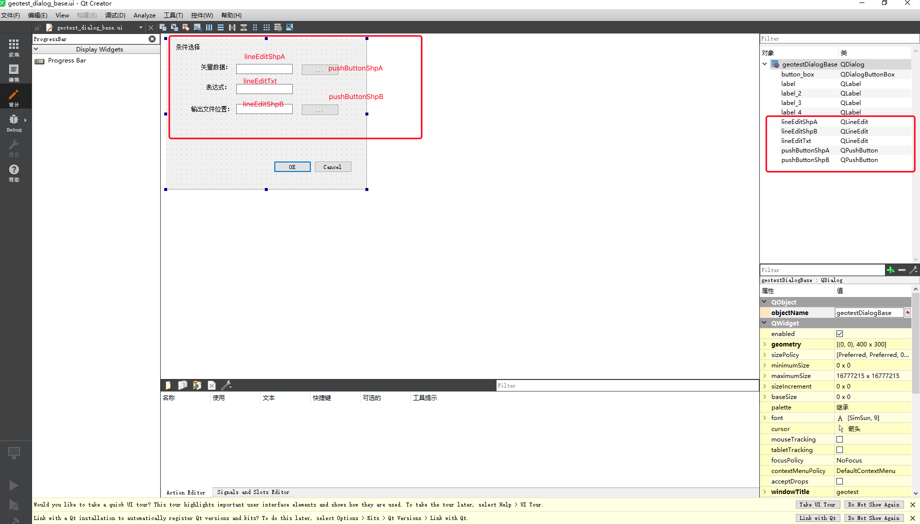
保存
编辑代码
使用pyCharm打开项目
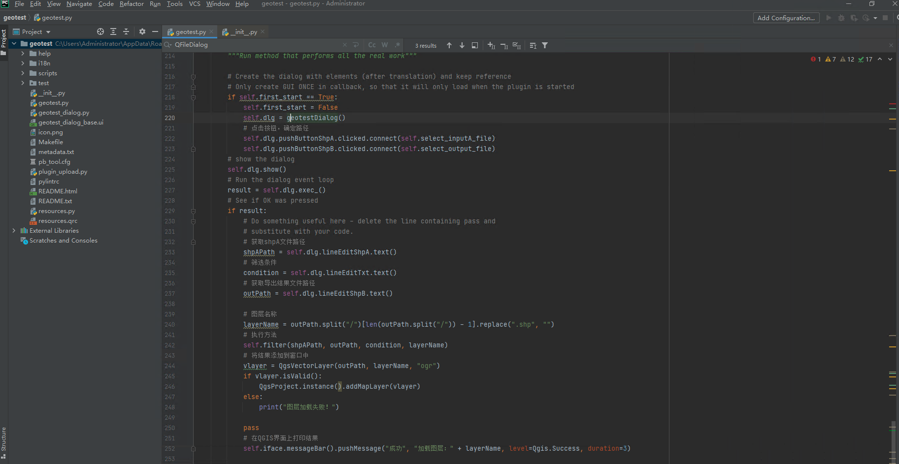
这里主要就是修改geotest.py文件
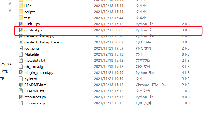
代码如下:
# -*- coding: utf-8 -*-
"""
/***************************************************************************
 geotest
                                 A QGIS plugin
 测试工具
 Generated by Plugin Builder: http://g-sherman.github.io/Qgis-Plugin-Builder/
                              -------------------
        begin                : 2021-12-13
        git sha              : $Format:%H$
        copyright            : (C) 2021 by sunbt
        email                : 1327398885@qq.com
 ***************************************************************************/

/***************************************************************************
 *                                                                         *
 *   This program is free software; you can redistribute it and/or modify  *
 *   it under the terms of the GNU General Public License as published by  *
 *   the Free Software Foundation; either version 2 of the License, or     *
 *   (at your option) any later version.                                   *
 *                                                                         *
 ***************************************************************************/
"""
import processing
from qgis.PyQt.QtCore import QSettings, QTranslator, QCoreApplication
from qgis.PyQt.QtGui import QIcon
from qgis.PyQt.QtWidgets import QAction, QFileDialog, QProgressBar
from qgis.core import *

# Initialize Qt resources from file resources.py


from .resources import *
# Import the code for the dialog
from .geotest_dialog import geotestDialog
import os.path


class geotest:
    """QGIS Plugin Implementation."""

    def __init__(self, iface):
        """Constructor.

        :param iface: An interface instance that will be passed to this class
            which provides the hook by which you can manipulate the QGIS
            application at run time.
        :type iface: QgsInterface
        """
        # Save reference to the QGIS interface
        self.iface = iface
        # initialize plugin directory
        self.plugin_dir = os.path.dirname(__file__)
        # initialize locale
        locale = QSettings().value('locale/userLocale')[0:2]
        locale_path = os.path.join(
            self.plugin_dir,
            'i18n',
            'geotest_{}.qm'.format(locale))

        if os.path.exists(locale_path):
            self.translator = QTranslator()
            self.translator.load(locale_path)
            QCoreApplication.installTranslator(self.translator)

        # Declare instance attributes
        self.actions = []
        self.menu = self.tr(u'&geotest')

        # Check if plugin was started the first time in current QGIS session
        # Must be set in initGui() to survive plugin reloads
        self.first_start = None

    # noinspection PyMethodMayBeStatic
    def tr(self, message):
        """Get the translation for a string using Qt translation API.

        We implement this ourselves since we do not inherit QObject.

        :param message: String for translation.
        :type message: str, QString

        :returns: Translated version of message.
        :rtype: QString
        """
        # noinspection PyTypeChecker,PyArgumentList,PyCallByClass
        return QCoreApplication.translate('geotest', message)

    def add_action(
            self,
            icon_path,
            text,
            callback,
            enabled_flag=True,
            add_to_menu=True,
            add_to_toolbar=True,
            status_tip=None,
            whats_this=None,
            parent=None):
        """Add a toolbar icon to the toolbar.

        :param icon_path: Path to the icon for this action. Can be a resource
            path (e.g. ':/plugins/foo/bar.png') or a normal file system path.
        :type icon_path: str

        :param text: Text that should be shown in menu items for this action.
        :type text: str

        :param callback: Function to be called when the action is triggered.
        :type callback: function

        :param enabled_flag: A flag indicating if the action should be enabled
            by default. Defaults to True.
        :type enabled_flag: bool

        :param add_to_menu: Flag indicating whether the action should also
            be added to the menu. Defaults to True.
        :type add_to_menu: bool

        :param add_to_toolbar: Flag indicating whether the action should also
            be added to the toolbar. Defaults to True.
        :type add_to_toolbar: bool

        :param status_tip: Optional text to show in a popup when mouse pointer
            hovers over the action.
        :type status_tip: str

        :param parent: Parent widget for the new action. Defaults None.
        :type parent: QWidget

        :param whats_this: Optional text to show in the status bar when the
            mouse pointer hovers over the action.

        :returns: The action that was created. Note that the action is also
            added to self.actions list.
        :rtype: QAction
        """

        icon = QIcon(icon_path)
        action = QAction(icon, text, parent)
        action.triggered.connect(callback)
        action.setEnabled(enabled_flag)

        if status_tip is not None:
            action.setStatusTip(status_tip)

        if whats_this is not None:
            action.setWhatsThis(whats_this)

        if add_to_toolbar:
            # Adds plugin icon to Plugins toolbar
            self.iface.addToolBarIcon(action)

        if add_to_menu:
            self.iface.addPluginToMenu(
                self.menu,
                action)

        self.actions.append(action)

        return action

    def initGui(self):
        """Create the menu entries and toolbar icons inside the QGIS GUI."""

        icon_path = ':/plugins/geotest/icon.png'
        self.add_action(
            icon_path,
            text=self.tr(u'geotest'),
            callback=self.run,
            parent=self.iface.mainWindow())

        # will be set False in run()
        self.first_start = True

    def unload(self):
        """Removes the plugin menu item and icon from QGIS GUI."""
        for action in self.actions:
            self.iface.removePluginMenu(
                self.tr(u'&geotest'),
                action)
            self.iface.removeToolBarIcon(action)

    # 加载被筛选文件的路径
    def select_inputA_file(self):
        filename, _filter = QFileDialog.getOpenFileName(
            self.dlg, "Select input file", "", "*.shp"
        )
        self.dlg.lineEditShpA.setText(filename)

    # 导出shp文件的路径
    def select_output_file(self):
        filename, _filter = QFileDialog.getSaveFileName(
            self.dlg, "Select output file", "", "*.shp"
        )
        self.dlg.lineEditShpB.setText(filename)

    # 在项目中加载矢量
    def filter(self, input_path, output_path, condition, layerName):
        # 按表达式提取
        alg_params = {
            # 表达式条件
            'EXPRESSION': condition,
            # 输入的矢量路径
            'INPUT': input_path,
            # 输出的矢量路径
            'OUTPUT': output_path
        }
        processing.run('native:extractbyexpression', alg_params)
        # vlayer = QgsVectorLayer(output_path, layerName, "ogr")
        # QgsProject.instance().addMapLayer(vlayer)

    def run(self):
        """Run method that performs all the real work"""

        # Create the dialog with elements (after translation) and keep reference
        # Only create GUI ONCE in callback, so that it will only load when the plugin is started
        if self.first_start == True:
            self.first_start = False
            self.dlg = geotestDialog()
            # 点击按钮,确定路径
            self.dlg.pushButtonShpA.clicked.connect(self.select_inputA_file)
            self.dlg.pushButtonShpB.clicked.connect(self.select_output_file)
        # show the dialog
        self.dlg.show()
        # Run the dialog event loop
        result = self.dlg.exec_()
        # See if OK was pressed
        if result:
            # Do something useful here - delete the line containing pass and
            # substitute with your code.
            # 获取shpA文件路径
            shpAPath = self.dlg.lineEditShpA.text()
            # 筛选条件
            condition = self.dlg.lineEditTxt.text()
            # 获取导出结果文件路径
            outPath = self.dlg.lineEditShpB.text()

            # 图层名称
            layerName = outPath.split("/")[len(outPath.split("/")) - 1].replace(".shp", "")
            # 执行方法
            self.filter(shpAPath, outPath, condition, layerName)
            # 将结果添加到窗口中
            vlayer = QgsVectorLayer(outPath, layerName, "ogr")
            if vlayer.isValid():
                QgsProject.instance().addMapLayer(vlayer)
            else:
                print("图层加载失败!")

            pass
            # 在QGIS界面上打印结果
            self.iface.messageBar().pushMessage("成功", "加载图层:" + layerName, level=Qgis.Success, duration=3)
具体功能如上有注释
使用reload刷新插件

效果
点击插件,选择数据和填入表达式条件
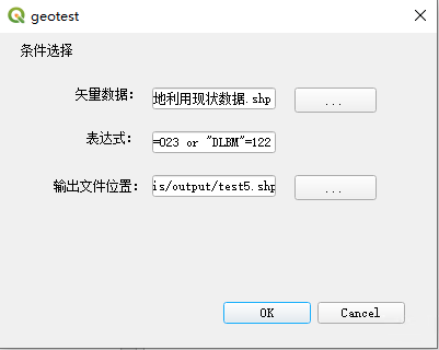
结果如下:
